shelter=yes on a highway=bus_stop NODE indicates there is a shelter nearby,
but says nothing about where it is exactly nor its size.
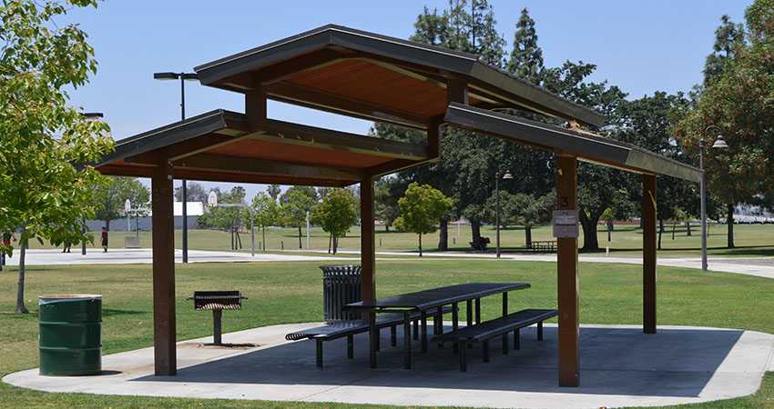
amenity=shelter
shelter_type=public_transport

on a CLOSEDWAY

indicates where the shelter is. height is not super important. I guess most
are about 2.3m high. If it is considered important I'll go out and measure
one and start tagging that on them. But that still doesn't make them
buildings. They are more like containers with glass wall panels and a metal
roof on a slab of concrete. Relatively easy to move and relatively small in
size.

Polyglot

Op ma 18 jun. 2018 om 15:28 schreef Bryan Housel <[email protected]>:

> There are also picnic shelters .. here they can have no walls just a roof
> to shelter from the heat of the sun or the occasional bit of rain.
> e.g.
> https://www.riversideca.gov/park_rec/sites/riversideca.gov.park_rec/files/pictures/Picnic%20Shelter%20Hunter%20hobby.JPG
>
>
> I would tag that as:
>
> amenity=shelter
> building=roof        ( <— this tag is really the point of the thread)
>
>
> The following three are no buildings from my point of view because they
> have one wall only. Either the two other walls do not fully stretch from
> the ground to the roof or the shelter itself can be removed easily.
> https://www.mapillary.com/app/?lat=49.08680549357706&lng=9.078079866007897&z=17&pKey=90pd5WuYg8zOk_L8dxLFFQ&focus=photohttps://www.mapillary.com/app/?lat=49.08985722389377&lng=9.07931005221235&z=17&pKey=oXQHKqb3Lc3Ae9IXj-5PHw&focus=photohttps://www.mapillary.com/app/?lat=49.10616167487336&lng=9.121348618135698&z=17&pKey=8xUGL_VKp45sOfd9VW7dUw&focus=photo
>
> I would not use `amenity=shelter` at all and instead tag those as
> https://wiki.openstreetmap.org/wiki/Tag:highway=bus_stop
>
> highway=bus_stop
> public_transport=platform
> bus=yes
> shelter=yes
> bench=yes
>
>
> There is building=roof but I would not use it for such shelters. They
> are not treated as buildings by the cadastre, why should I do? (If they
> are larger and have no walls, they
>
> Anything that should show up on a 3D map needs a `building` tag and maybe
> a `height`.
>
> I think that nobody of us knows the whole world and that's why I ask you
> not to decide on the default values of the whole world. If local mappers
> think that a shelter is a building, they will tag it as such. If they
> think that it does not qualify to be a building, they will not add the tag.
>
> In iD, the things we provide as presets, and how we render those things on
> the screen influence how people map.
>
> It sounds like from the discussion that we should not assume that shelters
> are buildings, and instead provide a field so that mappers can decide.
> Once we provide this field, we can expect a lot of people to use it.  (I’m
> trying to engage the tagging list a lot more so that people feel consulted
> when I change things in iD.)
>
> Thanks, Bryan
>
>
>
> _______________________________________________
> Tagging mailing list
> [email protected]
> https://lists.openstreetmap.org/listinfo/tagging
>
_______________________________________________
Tagging mailing list
[email protected]
https://lists.openstreetmap.org/listinfo/tagging