On Thu, Jul 26, 2018 at 3:40 PM marc marc <[email protected]> wrote:
> Le 26. 07. 18 à 19:39, Szem a écrit :
> did you read the previous (a few month ago) thread about this kind of
> issue ?
> imho *=licence is included in the current meaning of *=customers
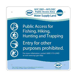
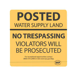
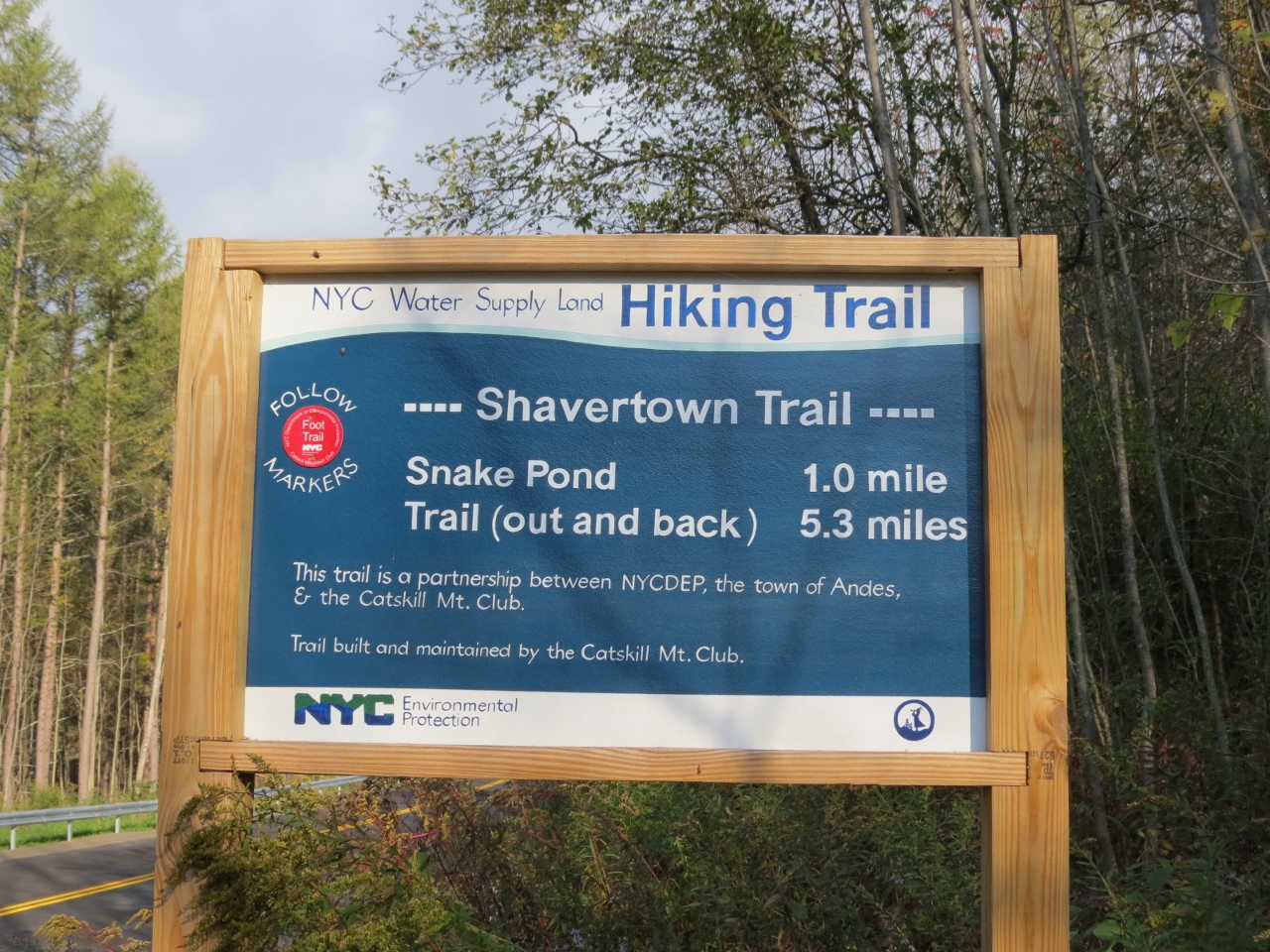
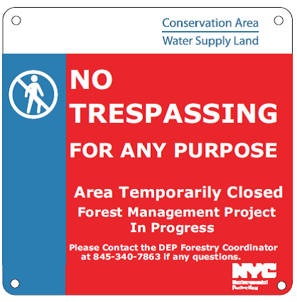
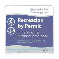
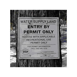
The only outcome of that thread - and several threads on the same
subject that preceded it - was that there was no consensus. I
understand that you are entirely convinced that your personal view is
the only correct one. Several others on the thread were convinced,
equally unalterably, that this regime is a special case of
'access=private' or 'access=no', and a few that it was not very far
removed from 'access=yes' or 'access=permissive'.

I'm equally convinced that 'access=permit' really is a thing unto
itself, and that attempting to force-fit it into one of the other
categories is misguided. (In fact, that force-fitting occasionally
comes across as being close to an admonition, "The data model is fine.
Fix your country!")

Several countries (US, CA, AU, apparently HU) have schemes where
government land is accessed by permit. The permits are often free or
granted for only a nominal fee, and usually the only condition is that
you have to identify yourself and agree to follow the specific
regulations pertaining to the area or way in question. The permits are
often more about getting a signed agreement to follow the rules than
they are about collecting fees or restricting numbers.

An example is that New York City's Bureau of Water Supply has all of
the following cases - and some of us want to distinguish among them on
the map!

access=yes - http://www.nyc.gov/html/dep/images/resources/watershed_sign3.jpg

access=private(or no) -
http://www.nyc.gov/html/dep/images/resources/watershed_sign4.jpg

access=permissive - I don't have a good example of signage, but there
are blazed trails that cross otherwise 'access=no' land and are signed
accordingly. Trailhead signs look like
http://4.bp.blogspot.com/-Wpha8SDETSw/VDfBDaXk3rI/AAAAAAAAkT4/aAKtBpPAs4g/s1600/IMG_6909%2B%281280x960%29.jpg,
the red markers regularly waymark the trail, but the 'NO TRESPASSING'
signs may be posted on both sides of the trail corridor.

access=permissive (but permission temporarily revoked) -
http://www.nyc.gov/html/dep/images/graphics/ashokan-temporary-closure.png
(I don't try to keep up with these projects on the map. They're too
volatile.)

access=permit -
http://www.nyc.gov/html/dep/images/resources/watershed_sign2.jpg (One
occasionally sees the obsolete
http://www.nyc.gov/html/dep/images/resources/watershed_sign1.jpg)

access=customers -
http://www.nyc.gov/html/dep/images/resources/watershed_sign5.jpg (You
pay for the deer tag and are allowed in in the hunting season only for
the purpose of hunting.)

From this list, perhaps people can see why I think that 'permit' is a
separate thing from the others. These areas aren't signed alike. They
truly do - to my thinking - have access restrictions that are
different in kind, not just in degree.

I've heard from some that the scheme I describe doesn't make any
sense. Nevertheless, it's there. It's field-observable (read the text
on the signs). I wish to produce maps that render all five of these
cases (public, private, permissive, customers, permit) differently.
(In previous discussions, I have been accused that such a desire is
'tagging for the renderer.' Nevertheless, it is an obvious logical
impossibility to render differently areas that are tagged alike.) I
wish to use these maps for planning purposes - to know, for instance,
whether I need to bring my New York City access card or parking tag on
a particular outing.

I do not see a consensus that 'access=permit' is a bad idea. Different
users repeatedly request it, and when I was unwise enough to bring it
up on my own accord, several other users agreed with me. Rather I see
that there is a failed consensus that it is a good idea, and no single
alternative has been presented for which there is a stronger
consensus. One user even asserted that the only way to map such an
area would be to create nodes for the individual signs!

I will confess that I've been remiss about wikifying my thoughts on
the matter, despite having entered quite a few 'access=permit' areas.
Part of the reason is that I'm virtually certain that doing so would
only be firing the first shot in an edit war. That's how badly mappers
disagree on this point.

_______________________________________________
Tagging mailing list
[email protected]
https://lists.openstreetmap.org/listinfo/tagging