On 15-09-2020 10:09, Martin Koppenhoefer wrote:
> Am Mo., 14. Sept. 2020 um 20:37 Uhr schrieb Supaplex
> <[email protected] <mailto:[email protected]>>:
> indeed, mapping the width generally requires measuring the width, and it
> is often not practical (unless you are willing to spend a lot of time or
> have very good aerial imagery at hand).
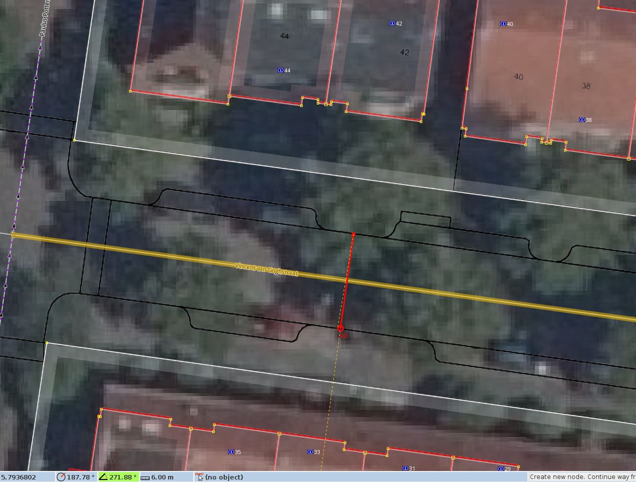
It will vary a lot per country and the available resources. In the
Netherlands we are blessed to have both yearly 25cm satellite imagery,
and municipal topography outline layers available. Those two, combined
are really quite nice to have.

In JOSM it looks like this:

http://jeroenhoek.nl/temp/josm-dutch-bgt.png

Measuring the width of a street (option 2) is often trivial with these;
in this case it seems to be a neat 6m.

I wonder if it is feasible to have JOSM render the width, optionally, as
a sort of semi-transparent background beneath the way-line. It would
make aligning these to the middle of the street even easier, and tagging
the width less error prone too due to the visual feedback.

Jeroen Hoek

_______________________________________________
Tagging mailing list
[email protected]
https://lists.openstreetmap.org/listinfo/tagging