On Thu, Sep 15, 2022 at 12:10 PM Sarah Hoffmann via Tagging <
[email protected]> wrote:
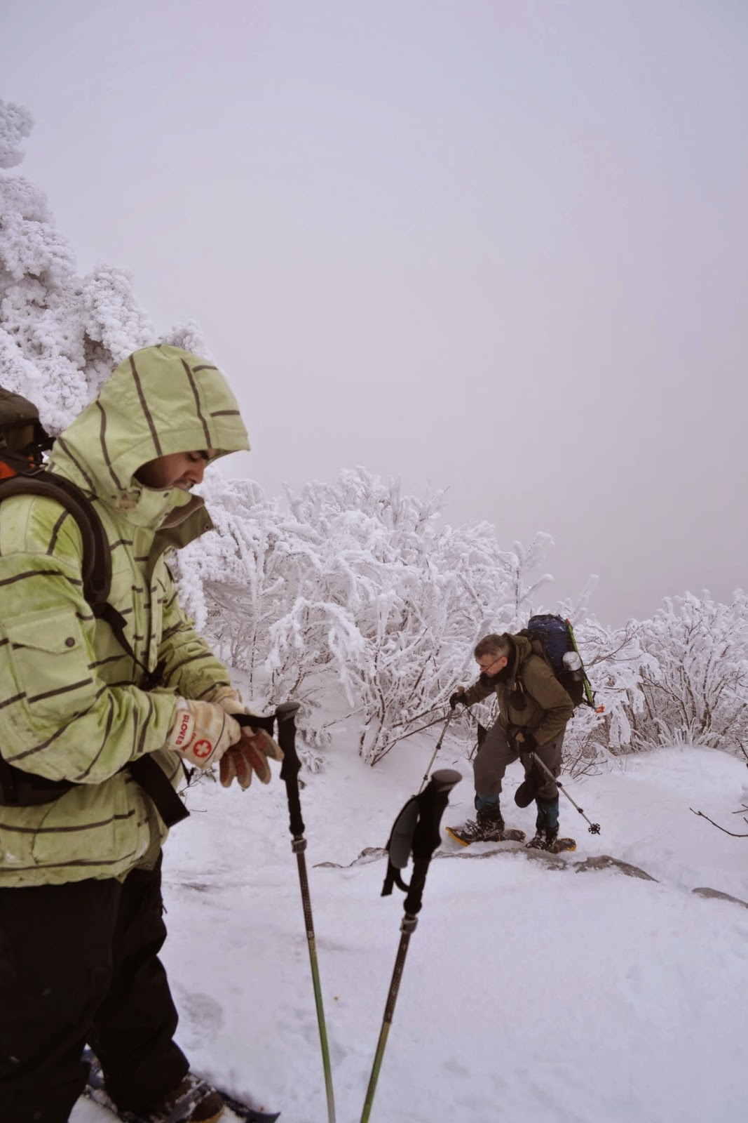
> To get this mess sorted out we should probably start with the discussion
> 'what is a hishway=path'. The current definition in the wiki is
> not helpful in any way. It basically says that anything can be a path,
> i.e. a way with only highway=path carries no information at all.
>

There's a saying in some hiking communities in the US:  "They call this
thing a trail."

The trouble with all the classifications is that they are subject to over-
and under-grading, and I'm afraid I don't have a good way to work around
that.

I think of one trail that I've been on multiple times that I've had
arguments about the grading of.  Some sample garden spots on that trail are
here. They're probably not the most difficult since they were places where
my daughter or I felt secure enough in our footing to pull out a camera.

https://flickr.com/photos/ke9tv/51335515628 - note the tall-ish man (me)
standing at upper right. You can see that the rock slab is totally covered
in tool marks!
https://flickr.com/photos/ke9tv/51334609512 - another treacherous slab -
covered with black ice in mid-October
https://flickr.com/photos/ke9tv/51336071749 - not horribly difficult, but a
slip could very well be fatal (and hikers have indeed died falling on that
trail)
https://flickr.com/photos/ke9tv/52336974320 - because the stuff just keeps
right on coming at you
https://flickr.com/photos/ke9tv/52360038196 - every bit as vertical as it
looks. You can see the red trail marker on the tree.

That trail has a very poor safety record - it's been called the most
dangerous hiking trail in the US - partly because of its reputation for
difficulty and danger. It draws people from New York City, with relatively
little hiking experience, who are looking to prove something. It's a point
of pride among some hikers to have done the whole 40 km (with about 2800 m
of elevation gained and lost again) in under 24 hours. I've never tried.
I'm an old man and know my limits.

For what it's worth, I'd carry technical ice gear on that trail pretty much
at any time between mid-October and mid-May.  It's a totally different game
in winter, and up in the hills winter comes early and stays late.
https://3.bp.blogspot.com/-oOi7vvpUt0Q/VJnktGwmMDI/AAAAAAAABoY/xYpcKlxPPqI/s1600/DSC_3880.JPG
is a typical scene - that was the ledge where we were switching from
snowshoes and ski poles to crampons and ice axes. (Oops, wait, that's a
different trail. Same mountain range, though.)

Again, for what it's worth, my daughter and I encountered one party
speaking Hoch-Alemannisch among themselves. (Or Schyzertütsch? I find that
general set of accents pretty incomprehensible, my German isn't very
good.)  The one with the best English said to me, "These mountains aren't
very high, but they're _demanding!_"  (I figure that if someone from the
actual Alps is saying that, they're probably demanding.)

One guidebook says of one section: "The rock is sound, holds are plentiful,
and route-finding is easy. Nevertheless, exposures are dramatic, and less
confident parties may wish to use a rope."

What SAC scale?  I've had arguments about that before.  I've had people
solemnly assure me that the trail is mere 'hiking' - and others tell me
that it has definitely crossed over beyond 'demanding mountain hiking' into
'alpine hiking'.  I'd put it into class 4 on the Yosemite scale (which,
being an American, is what I know best).  But a great many climbers believe
that class four is a myth:
https://www.summitpost.org/class-four-is-a-myth-problems-in-yds/891794. The
hardest moves are probably in the 5.3 or 5.4 range (again on the Yosemite
scale), but they're not exposed. My guess is that The Powers That Be are
willing to blaze it as a hiking trail because the hard moves aren't exposed
and the exposed moves aren't hard.

It's a hard problem.  Experienced climbers think nothing of this stuff, and
put it all in the "not interesting" bucket.  But they're the only ones with
enough experience to grade the trail accurately. What you need is grading
from an experienced _guide_, well versed in assessing trail difficulty with
respect to the ability and experience of clients.  But you don't get a lot
of those people mapping.

Instead, you have trails graded by folks like
https://youtu.be/k8XmjebwoQw?t=110 "You all right?" and
https://youtu.be/k8XmjebwoQw?t=134 "Holy sh*t!" who run on rock that I
climb - or by duffers (by comparison with those guys, at least!) like me.
Whose definition of 'scramble' should prevail?

Disclaimer. I'm terrible at climbing. I decided a long time ago that I was
going to stay terrible at climbing because the folks who get good at
climbing seem to have an unfortunate habit of winding up dead. I have a
good time Out There limiting myself to 'technical hiking' as opposed to
'real climbing.'

--
73 de ke9tv/2, Kevin
_______________________________________________
Tagging mailing list
[email protected]
https://lists.openstreetmap.org/listinfo/tagging