On 10 Aug 2009, at 14:48, Peter Reed wrote:
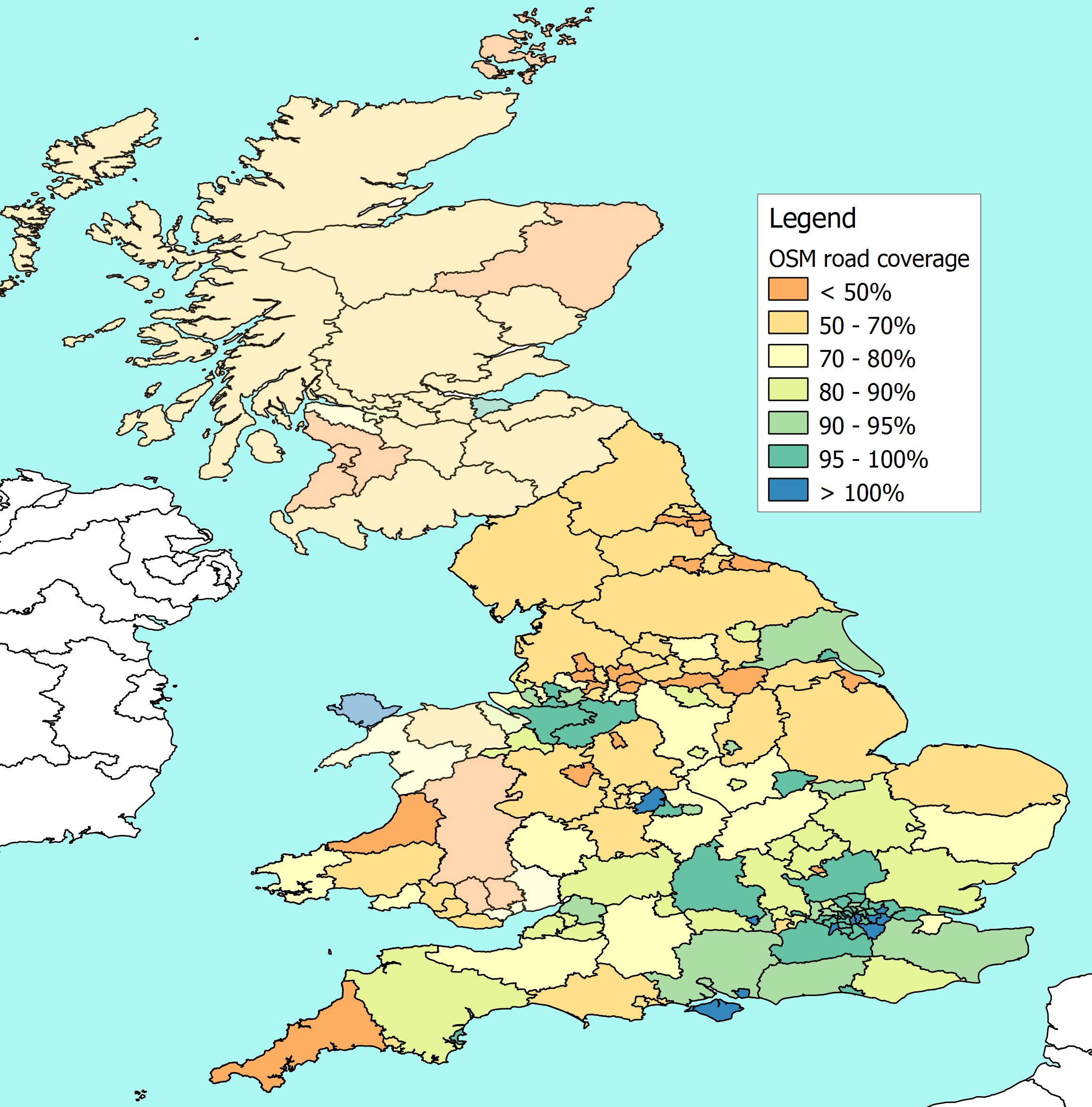
I’ve just posted an updated map of UK coverage at
http://www.reedhome.org.uk/Documents/OSMCover.png

There are a number of significant changes in this version:
a) As I half suspected, there was an error in the way I was
handling map projections in the previous version. This resulted in
overstating the length of roads on OSM. I think I’ve now fixed this,
and it seems to give more plausible results
b) We now have sensible looking boundaries for all the English
higher level councils (Counties, Met boroughs, London & Unitaries)
c) In theory, all the counties should now cover the admin
boundary, not the ceremonial area. I’ve done some quick checks, and
so far they’ve been OK – though Buckinghamshire looks suspicious.
Previously some unitary authorities were counted twice, and pushed
up the county figures
It's good to see continuing progress with English boundaries. I have
added Leicestershire council and Plymouth UA to the English Boundaries
page.
However... I can't find find an administrative boundaries for
Derbyshire County Council or for Staffordshire County Council. There
are ceremonial versions of these which you might still be using instead.
Thanks of all your work on this Peter. I am now offended that Suffolk
is only light green! I guess I will have to do something about it, but
that is the point. Anyone fancy mapping Suffolk? There are some lovely
towns that need work.
One small suggestion - you might like to use a 'thermal' colour range;
currently I am not able to guess which colour is associated with the
highest coverage and the lowest etc. Feel free to use colours used by
OSM Mapper in the 'thermal' range if that is useful.
Regards,


Peter Miller
_______________________________________________
Talk-GB mailing list
[email protected]
http://lists.openstreetmap.org/listinfo/talk-gb
_______________________________________________
Talk-GB mailing list
[email protected]
http://lists.openstreetmap.org/listinfo/talk-gb