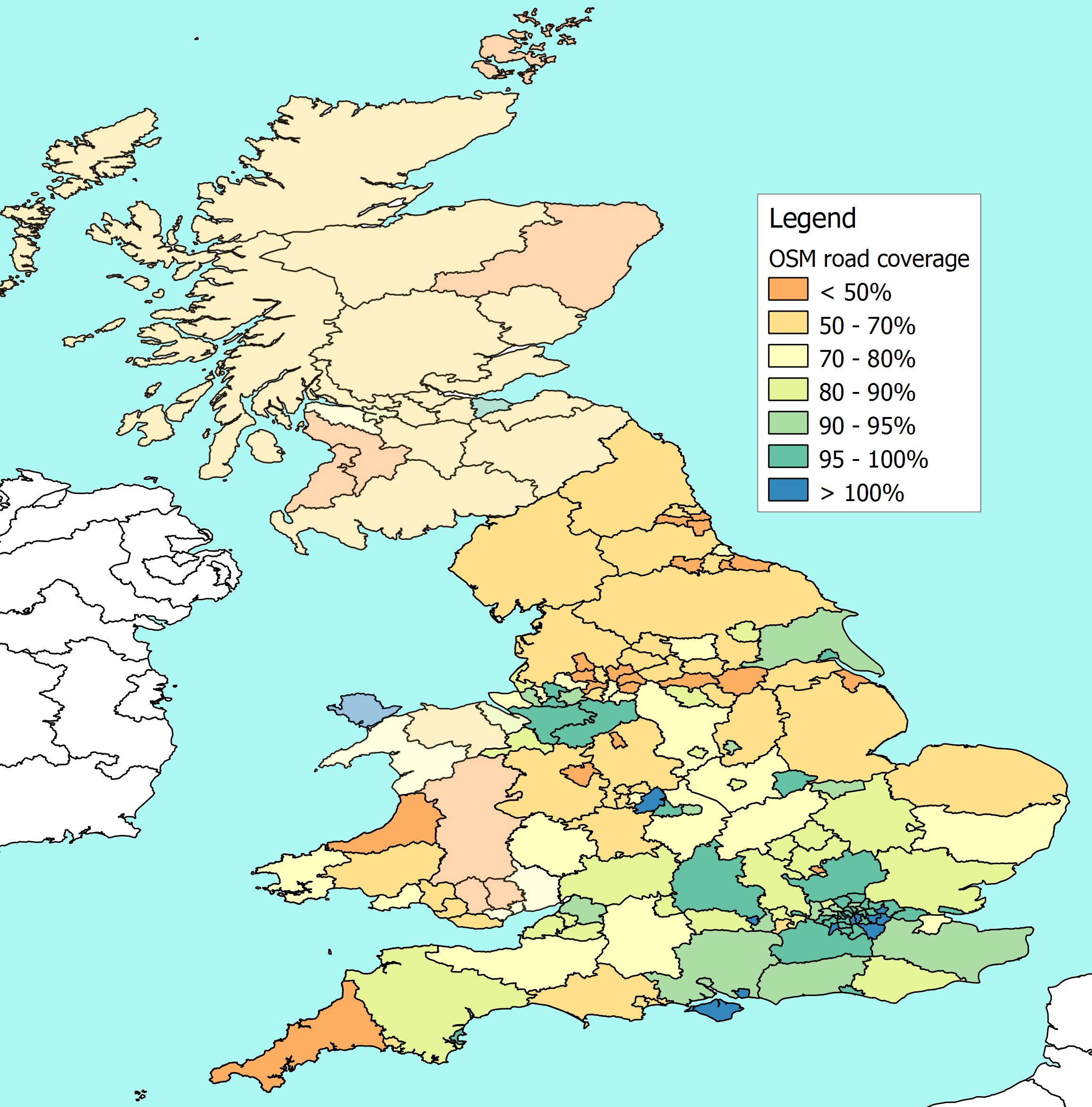
I have now fixed the problem I was having with measuring the length of roads
in Buckinghamshire, and I have uploaded a new map of UK road coverage here -
http://www.reedhome.org.uk/Documents/OSMCover.png
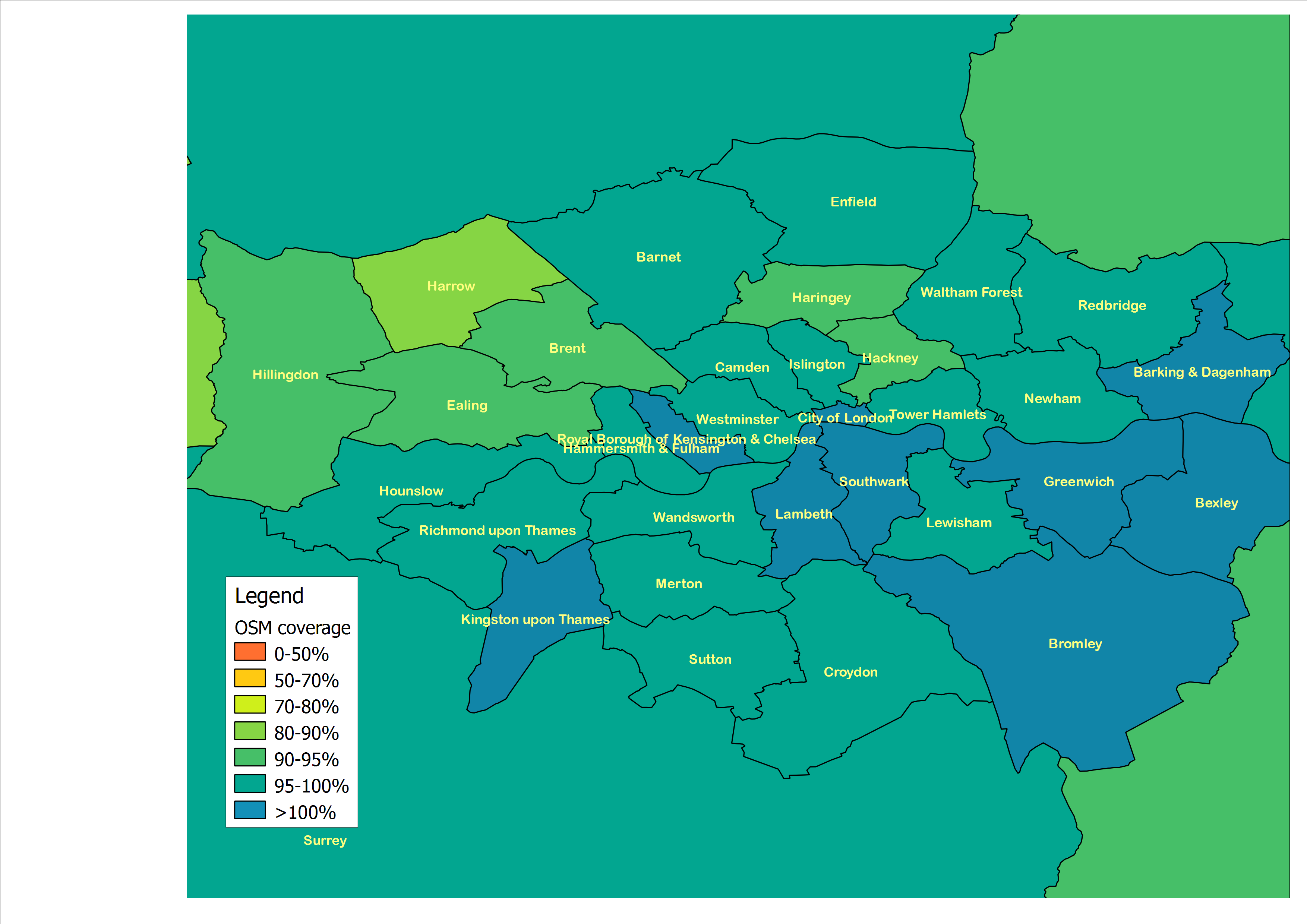
FWIW here is a close up view of London as well -
http://www.reedhome.org.uk/Documents/OSMLondon.png


For anyone who hasn't seen the previous conversations, these compare the
road lengths reported by the Department for Transport against the length of
roads that have been plotted on OSM.


In other words in Cornwall, for example, the DfT reckons that there are
about 7,500km of road, and about 3,500 have been plotted on OSM leaving
about 4,000km to be added to OSM.


In Reading, on the other hand, the DfT reckons there are just under 400km of
road, but just over 400km have been plotted on OSM, leaving about 5km for
the DfT to build.


I am still finding and removing glitches, but as things stand the highest
levels of coverage (on these measures) seem to be in a number of London
boroughs, the Isle of Wight, Birmingham, Reading and Portsmouth.


I'll try to find time tomorrow to upload a summary of the numbers themselves
for anyone who is interested.
_______________________________________________
Talk-GB mailing list
[email protected]
http://lists.openstreetmap.org/listinfo/talk-gb