Hi,
Some of you may recognize my name, I came up with the name "Viking" :) but
have not been so active in recent years...
I've been using Viking to plan a hiking trip and needed some features. One
of the things was I wanted was to define an box/area and scale for a map
that I would like to generate to an image file, and then be able to
generate it at any time. In other words, I define the height and width and
center and scale of the map once, and then can generate it again anytime
later. That way, I could edit my trail and come back and generate the new
maps, and I don't have to go back to the exact same place as before. Also,
I can create many of these layers and make sure I have maps covering my
entire hike. Another feature I wanted was the ability to overlay a compass
rose (see http://www.phlumf.com/travels/cdt/cdtgps.shtml) on a map. I have
written some code to do these things pretty much to my satisfaction, there
are a few bugs and improvements (see the TODO-IMAGEBOXLAYER) but as I have
a few other things I want to implement I might not get to them. Anyway,
that branch is available at:
https://github.com/evanbattaglia/viking/tree/imageboxlayer
A sample compass rose is in doc/sample-compassrose.png.
Let me know if any of you have questions about this feature.
Just FYI, some of the features I would like to implement that I believe are
not in Viking, and may or may be working on depending on time:
* labeling a track with its length, probably in the middle, and showing
the endpoints more prominently. Again, this is to generate map similar to
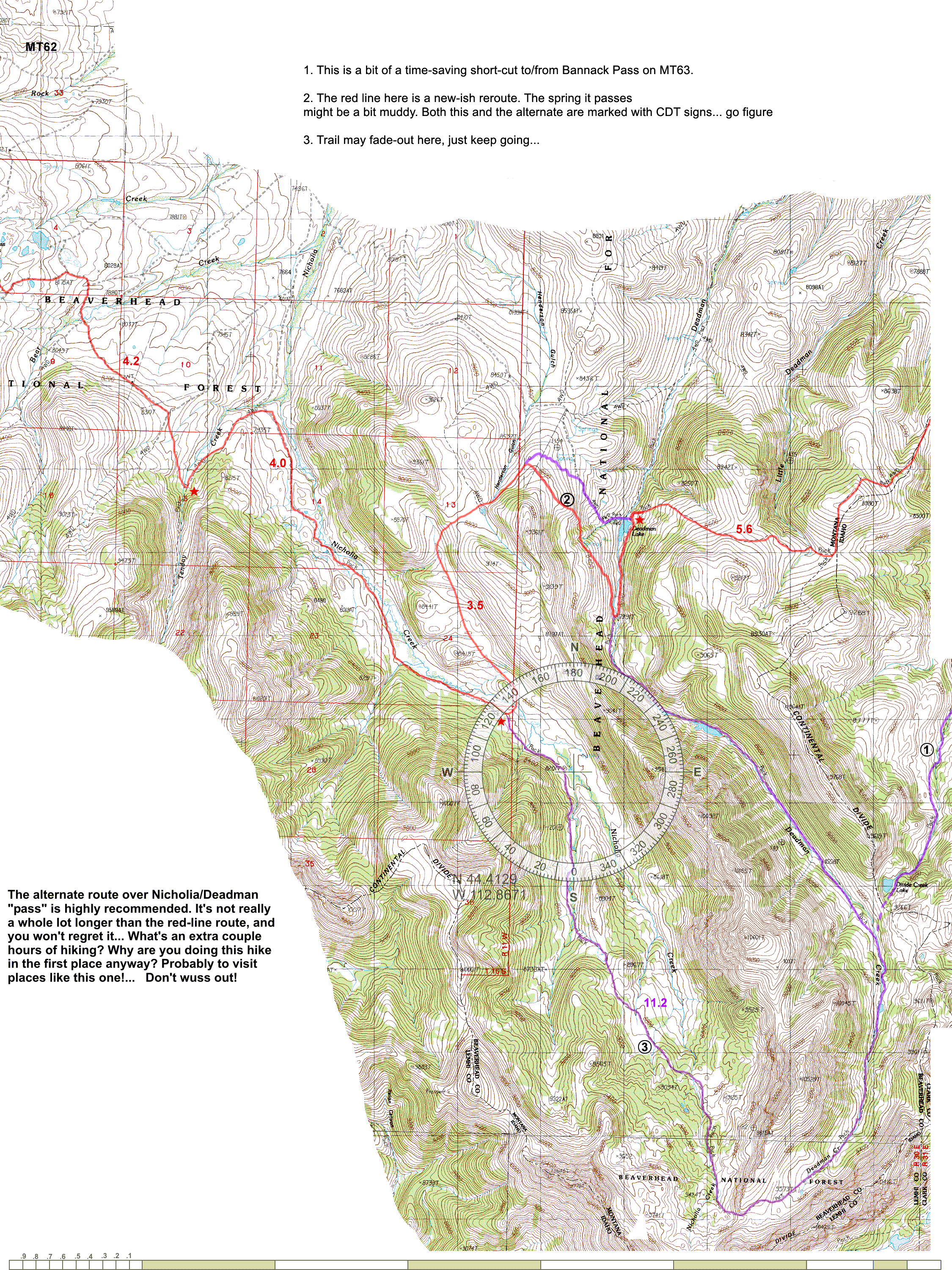
http://www.phlumf.com/travels/cdt/cdtmaps.shtml (see sample
http://www.phlumf.com/travels/cdt/mt62.gif)
* Ability to merge all TRWlayers under a particular AggregateLayer
* Have a tool that can connect trails to find the shortest path amongst
your tracks using Dijkstra's algorithm, A*, etc. It would also allow for
trails which don't exactly touch by setting a threshold wherein two track
endpoints are deemed "close enough" and an edge connecting them in the
graph is created. I want this to be able to choose between different
combinations made up of tracks and to see what the shortest route would be.
It would also be useful for reconnecting a track that has been split up
into segments that all touch each other but are unordered.
BTW, one question -- is there a reason we are still using the sourceforge
git repo? We use github at work and it's really nice because people can
make forks and do pull requests easily, see the network graph, etc.
Evan
------------------------------------------------------------------------------
Better than sec? Nothing is better than sec when it comes to
monitoring Big Data applications. Try Boundary one-second
resolution app monitoring today. Free.
http://p.sf.net/sfu/Boundary-dev2dev
_______________________________________________
Viking-devel mailing list
[email protected]
https://lists.sourceforge.net/lists/listinfo/viking-devel
Viking home page: http://viking.sf.net/