Hi!

With other contributors in Connecticut, we would like to import
building footprints. We have evaluated different data sources, and
concluded that no Connecticut-wide sources were usable without a lot of
manual work to fix building geometry.
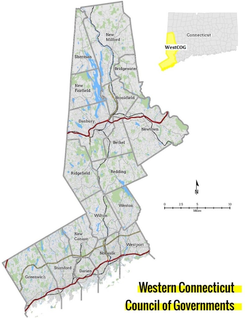
We found that the WestCOG has very accurate building footprint data on
its territory (south west Connecticut), available online and with a
compatible license (CC0):
http://data.westcog.org:8080/GIS_data/Buildings.gdb.zip
That's 513,141 buildings, and 296,423 building parts in some of them,
that cover this territory:
https://westcog.org/wp-content/uploads/2015/08/WestCOG_Locus_Map-e1439920850177-790x1024.jpg

Other COGs unfortunately don't share this data online. We hope that a
successful import could be a convincing argument for other COGs to open
their data.

We have documented our current plan at
https://wiki.openstreetmap.org/wiki/Connecticut/Western_COG_Building_Import
on the wiki.

We have contacted local mappers of this part of
Connecticut (we are based in and around New Haven, not is south-west
Connecticut), with no negative feedback and 2-3 positive responses. We
have created a process to convert the data from WestCOG to OSM tags and
files that can easily be loaded in JOSM.

We have never done an import before, so we'd appreciate any advice on
how to properly do the import. From our reading the wiki, we should use
a separate user to import the data. Is that one shared user for the
import, or one user for each person importing data?

We have identified potential issues with this import: roads and
waterways come from an old import and might very well cross the
buildings we'd like to import. For now, we have a task on the osmus
task manager to try and correct road geometry (currently finished at
50%) that covers Fairfield County (WestCOG is a part of Fairfield
county): https://tasks.openstreetmap.us/project/193. This is not going
very fast, so we'd like to start the import even though we haven't
finished the tasks. We plan to fix road and water issues as we
encounter them instead, while encouraging people to go and fix them
independently from our import.

WestCOG currently has almost no building mapped, but obviously we plan
to keep existing buildings and only import buildings that are not yet
mapped.

What is a good way to split this import? Is there a good size per
changeset that you could recommend?

Thanks for your help!

Julien

_______________________________________________
Talk-us mailing list
Talk-us@openstreetmap.org
https://lists.openstreetmap.org/listinfo/talk-us