On Mon, Jun 8, 2009 at 11:52 PM, Chris Wilkinson wrote:
> As part of my ongoing Brisbane scenery revamp I tried an experiment to
> create apron markings today. I created a shapefile containing lines closely
> following the actual markings on the international terminal apron, then
> shape-decoded that shapefile to a new work/ApronMarkings folder, then ran
> fgfs-construct adding ApronMarkings to the data sources on the command line.
> After copying the output to my current scenery folder I created a new
> material with the same name in materials.xml pointing it to a bright yellow
> texture.
>
> When I ran fg I couldn't see the lines, so I quit, then renamed the
> YBBN.btg.gz file so it wouldn't load, restarted fg, and still no lines. Is
> there a way to include extra datasets into the genapts process, or can it be
> done with the fgfs-construct process?
>
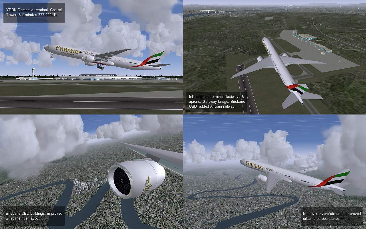
> For those interested in downloading the scenery I need to figure out if I'm
> allowed to distribute derivative works based upon the shapefiles I've used
> (licensed for personal use only), which come from Geosciences Australia
> (govt dept). Until I know that here is a screenshot of the latest build...
>
> http://blobster.50webs.com/ybbn-latest.jpg
Hi Chris, your work looks very nice!

I'm writing this off the top of my head so keep that in mind. :-)

It sounds like you are trying to handle the airport aprons from terragear,
and not genapts.

I know the terragear code is setup to collapse points together if it
determines they are very close together.  This is to help avoid slivers and
gaps and other issues that generally arise from our polygon clipping
routines trying to clip arbitrary real world data which we then have to pass
to our triangulator to do a Delauney triangulation.  If the clipped data set
has nearly coincident points (or a huge variety of other artificats that the
polygon clipping code can possibly emit) it will blow up the triangulator.
So collapsing nearby points together was one trick (among many others) to
try to keep the data sane as it progressed through the terragear pipeline.

I do know that for terragear, these thresholds will almost always collapse
out something like a 4" wide line.  I did some work about a year and a half
ago trying to represent more detailed roads, with road markings in
terragear.

At one point I did some work to play with changing some of these thresholds
so that lines didn't collapse out.  That was partially successful.

Then I ran into the code that assumes very long skinny triangles (like a
long straight line might generate) must be a sliver artifact and these still
collapsed into the neighbor area.  So I changed the thresholds on those.

I can't remember if I ran into other road blocks ... probably.  Ahh, one
thing is that you quickly run into limits of the number of points and
structures that can be represented in a scenery file.  So I played around
with extending that a bit.

So then at the end of all this, I did get something that looked pretty close
to what I was hoping for when viewed from the top down, but unfortunately
this is then drapped over the raw terrain points which leads to a lot of
scattered elevation noise and made the result undrivable, and made the
result look bad becasue there could be odd lateral slopes on these thin
lines ... and it was just a mess.

So then I did a bunch of work trying to level and smooth adjoining points
that were part of "lines" or "roads".  This is a similar approach to what we
did to try to level lakes and limit the slope of rivers.  That also improved
the situation, but it wasn't perfect.  I struggled quite a bit trying to
beat this smoothing approach into submission and got something that was
almost, but not quite useful.

So terragear was not designed with this level of detail in mind
unfortunately.  It's good to hear that Fred has started looking at Robin's
v8.50 airport format.  I think there is much more hope of doing this
successfully within genapts ... if for no other reason, that genapts goes
out of it's way to fit a "smooth" surface to the airport area, so one major
headache in terragear goes away.

Fred, were you thinking of cutting these lines into the surface (with hard
polygon edges) or drawing them over the top like with a glPolygonOffset()
approach?  Or something else?  It would be really great to be able to add
taxi lines and other markings to our airports.

Best regards,

Curt.
--
Curtis Olson: http://baron.flightgear.org/~curt/
------------------------------------------------------------------------------
Crystal Reports - New Free Runtime and 30 Day Trial
Check out the new simplified licensing option that enables unlimited
royalty-free distribution of the report engine for externally facing
server and web deployment.
http://p.sf.net/sfu/businessobjects
_______________________________________________
Flightgear-users mailing list
Flightgear-users@lists.sourceforge.net
https://lists.sourceforge.net/lists/listinfo/flightgear-users