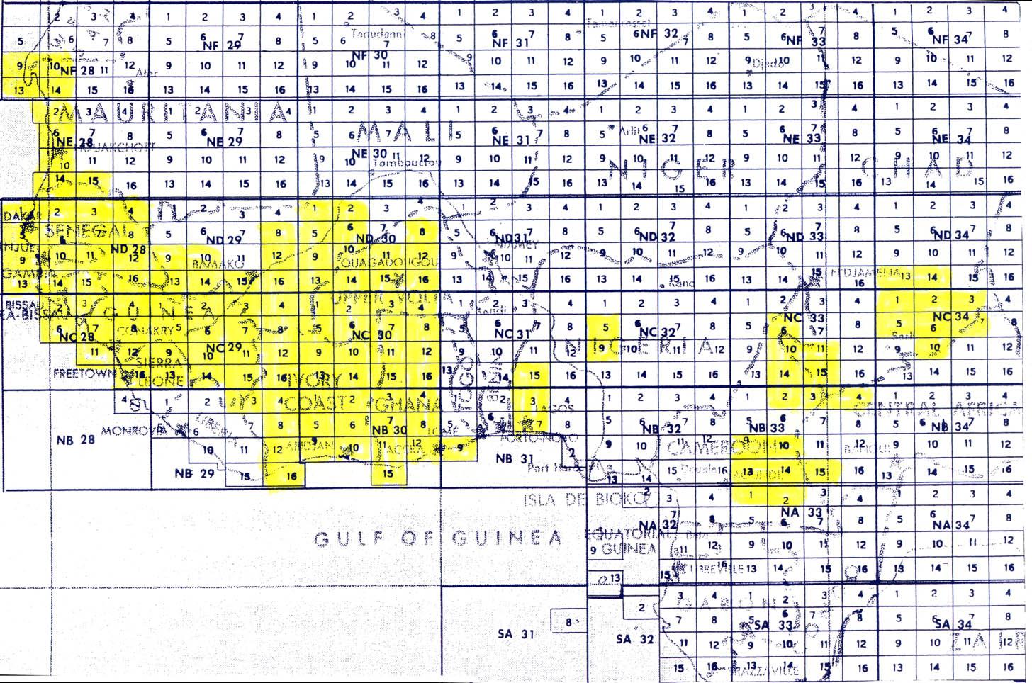
Yes, AMS-2 is for US Army Map Service (AMS), Series G504, 1955-
(1:250,000) (Actually many from 1963).
Unfortunately, its available maps only cover the extreme north of
Liberia (beside Sierra Leone and Guinea):
https://www.lib.utexas.edu/maps/ams/west_africa/txu-oclc-6595921-index.jpg


There is also an older AMS Series G541, from 1942, which is apparently
available only for Sierra Leone - that it covers entirely, and has been
set up in layer 167:
http://mapwarper.net/layers/167

available as TMS (in JOSM syntax) as:
http://mapwarper.net/layers/tile/167/{zoom}/{x}/{y}.png


It is the only layer (among the three layers of US topographic maps,
JOG, AMS-2 and AMS) that includes a map over Bonthe District. It can
also be interesting to see the historic evolution, and sometimes
"old_name" or "alt_name".


Best wishes,

Jean-Guilhem


Le 20/08/2014 16:44, Andrew Buck a écrit :
> I am working on rectifying some more of the white AMS maps, but if I
> recall correctly, even the ones that cover liberia are basically
> blank.  I do not know of any other sources that are free of copyright
> for the area.
>
> You can see the map layer and which maps have yet to be rectified here:
>
> http://mapwarper.net/layers/150
>
> Note that when new maps come online you might have to right click in
> josm and do the 'flush tile cache' before they will show up for you.
>
> For the ones that you are not sure of, even just getting a fixme tag
> on them and leaving them where they are is an improvement.  They tend
> to be within a mile or two of their correct position anyway so just
> having them in the DB for nominatim is already a step forward.
>
> -AndrewBuck
>
>
> On 08/20/2014 09:13 AM, Blake Girardot wrote:
> > The white maps only seem to cover SL and northern Liberia.
>
> > The JOG map seems to be the only locating reference for the
> > majority of Liberia.
>
> > If there is some other good source for location in Liberia I'd love
> > to know about it. The JOG map is good for the items it has, but
> > there are a lot not on that map.
>
> > The square I am working on now has 280 nodes imported from GNS (the
> > most I have seen so far), but only about 80 are on the JOG map
> > leaving the other 200 to basically be just guesses based on what is
> > nearby and since they are all marked as skip=yes just going by
> > proximity is not very good.
>
> > Most of them I am just going to leave exactly where they imported
> > and mark them fixme=location approximate
>
> > I would love another map source for Liberia.
>
>
>
>
> > On 8/20/2014 9:45 AM, Tom Taylor wrote:
> >> The work I've done so far has been easy because someone else did
> >> most of it. However, I have noted source discrepancies: JOG,
> >> AMS-2 (don't know what that is), but not the US Army Topo maps.
> >> In fact, JOG is fairly sparse and the latter are the prime
> >> source. Would AMS-2 be the US Army reference? Example: Node:
> >> Tangahun (2967629931).
> >>
> >> Tom Taylor TomT5454
> >>
> >> _______________________________________________ HOT mailing list
> >> [email protected]
> >> https://lists.openstreetmap.org/listinfo/hot
>
> > _______________________________________________ HOT mailing list
> > [email protected] https://lists.openstreetmap.org/listinfo/hot
>
>
> _______________________________________________
> HOT mailing list
> [email protected]
> https://lists.openstreetmap.org/listinfo/hot
_______________________________________________
HOT mailing list
[email protected]
https://lists.openstreetmap.org/listinfo/hot